Back
to Top

 
  • Share this page on Facebook
  • Print this page

Warburton - Gridded and Located airborne geophysics
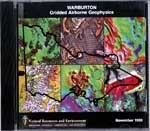
Warburton - Gridded and Located airborne geophysics
Category: Geophysical Data Packages Product Code: MP-D-171364
Free

Product Type*
Download
     Download Info.
 
Sector
Which sector do you represent?


Product description:

The compact disc contains the following:
  1. Compact disc index - Shows the areas covered by data on CDs in this series.


  2. Metadata - Digital Airborne Surveys Index Map. This map shows locations and gives specifications for all digital airborne geophysical surveys in Victoria.


  3. Survey Data - Open file State government and company surveys. Gridded data in ER Mapper format (.ers) and pre-prepared images of these grids (.alg). Located airborne geophysical data (ASCII columns), compressed (.gz) and uncompressed (.ldt). (Note: Compressed files (.gz) can be uncompressed using the Gzip software provided or using a windows based application like Winzip.) Warburton - Includes surveys Mt Wellington VIMP (2465) and Mansfield VIMP (3149).


Download option:
Please note that the CD/s representing the original data package have not been modified or updated, but simply repackaged as downloadable ZIP files to offer the same information via the “Download” link above.

Unfortunately some included software and web addresses may now be out of date.