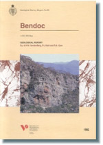
GSV Report 90 - Bendoc 1:100 000 map geological report
 |
| |||||||||||||||||||||||||||||
Product description:Download The downloadable version of this report is supplied in PDF format. Abstract This report describes the geology of the area covered by the Bendoc 1:100,000 mapsheet 8623. It gives a comprehensive account of the physiography, geological history and landscape evolution, Palaeozoic and Cainozoic rock units, structural and economic geology, and a comprehensive list of references. Particular emphasis is placed on the Ordovician to Early Silurian marine sedimentary rock sequence, which is subdivided into three main units: Pinnak and Broadbent River Sandstone (deep marine turbidites, mudstones and chert), Bendoc Group (deep marine black shale and mudstone) and Yalmy Group (shallower? marine well-washed turbidites and mudstones), and the Early Devonian Errinundra Group (shallow marine mixed volcanic and non-volcanic clastics, volcanic mass-flow deposits, lava and limestone). Depositional models are suggested for each. The petrography, structure and age of the Kuark Metamorphic Complex (high T-low P biotite and cordierite-bearing schists) are described. Six syntectonic I-type plutons intrude the metamorphics, and there are six major and several smaller granitoid intrusions, both I and S-type, that lie outside the metamorphic belt. Petrographic descriptions are given for all. The Palaeozoic rocks were affected by four major deformations: the Silurian Benambran and Quidongan deformations, the Middle Devonian Tabberabberan, and the Carboniferous Kanimblan Deformation. Each is characterized by a different fold style, and particular emphasis is placed on the fold-and-thrust style of deformation west of the Yalmy and McLauchlan Creek faults. The post-Palaeozoic history is one of prolonged erosion, which rejuvenated after the Cretaceous uplift. The landscape and its evolution, and Cainozoic sedimentation and volcanism, are described in the context of this uplift. Descriptions are supplied for all metallic and non-metallic mineral deposits, and a comprehensive list of references is included. Numerous photographs and line drawings complement the text. Bibliographic reference VandenBerg, A.H.M., Nott, R.J. & Glen, R.A., 1991. Bendoc 1:100 000 map geological report. Geological Survey of Victoria Report 90. Related products:
| ||||||||||||||||||||||||||||||


