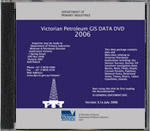
Victorian Petroleum GIS Data 2006
 |
| |||||
Product description:Version 3.1a, July 2006This GIS data package has been generated from Minerals and Petroleum's dbMap Oracle database to include openfile wells, seismic and culture data. This package includes geographic locational data for 2D seismic lines, 3D survey polygons, oil and gas field outlines, well locations, permit boundaries. In addition, cultural features such as roads, rivers, pipelines and coastlines. Data formats of this DVD include Petrosys files, ASCII, UKOOA and sundry other formats. Download This data package is free to download as a collection of compressed ZIP files - Victorian Petroleum GIS Data GENERAL (ZIP 213MB) Victorian Petroleum GIS Data SEISMIC (ZIP 138MB) Victorian Petroleum GIS Data PSEIS (ZIP 1.01GB) Please be patient when downloading large files as this might take some time depending on your internet connection. | ||||||

