28 - Bung Bong geological parish plan - 1:31 680 (1900)
 |
| |||||||||||||||
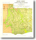
Product description:Parish of Bung Bong, counties of Talbot and Gladstone. Preview map (75 dpi, 587KB) Download The downloadable version of this map is supplied in PDF, TIF and ZIP formats (georeferenced image). Bibliographic reference Hunter, S., 1900. Parish of Bung Bong 40 chains to 1 inch, geological map. Department of Mines, Victoria. Related products:
| ||||||||||||||||

