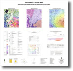
018 - Nagambie 1:100 000 geological interpretation of geophysical features map
 |
| |||||||||||||||||||||||||||||||||||||||||||||||||||||||||||||||||||||||
Product description:Preview map (75 dpi, 889 kb) Download The downloadable version of this map is supplied in PDF and TIF formats. Bibliographic reference Slater, K.R., 1997. Nagambie 1:100 000 map geological interpretation of geophysical features. Geological Survey of Victoria. Related products:
| ||||||||||||||||||||||||||||||||||||||||||||||||||||||||||||||||||||||||