104 - Maryvale geological parish plan - 1:31 680 (1927)
 |
| |||||||||||||||
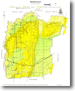
Product description:Parish of Maryvale. Preview map (75 dpi, 507KB) Download The downloadable version of this map is supplied in PDF, TIF and ZIP formats (georeferenced image). Bibliographic reference Ower, L.H. & Ferguson, W.H., 1927. Parish of Maryvale 40 chains to 1 inch, geological map. Department of Mines, Victoria. Related products:
| ||||||||||||||||

