Digital geological model of the Latrobe Valley coal resource - 2003
 |
| |||||||||||||||
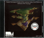
Product description:A new three-dimensional picture of the vast brown coal resources in the Latrobe Valley was launched in May 2003. The digital three-dimensional model shows the distribution and quality of the brown coal in a 1100 sq km area between Moe and Rosedale - including the State's vital electricity generating resource. It allows fast and versatile assessments of this resource and captures 90 years of knowledge that was accessible only as paper records. It will be used extensively in assessments of coal utilisation, land use, ground water and subsidence.The coal seams in the model area are phenomenal for their size and quality. The model calculated a resource of 129 000 million tonnes of coal. Most of the States electricity is generated utilising coal from the Loy Yang, Hazelwood and Yallourn mines. In addition to these massive operations, 53 000 million tonnes of economic coal is unallocated at this time. Economic coal in this context is defined as less than 10% ash, greater than 3 m thick, greater than 1:2 coal: waste ratio, less than 300 m depth. Opportunities exist for the continued utilisation of these resources for electricity production, gasification, liquefaction and other coal conversion processes; as well as solid fuel for industrial, domestic and other uses. Whilst these resources were calculated using the model, its strength is versatility. It readily takes account of changes to criteria as fundamental as "what is coal?". Roofs and floors were interpolated for the sixteen thickest brown coal seams from over 8000 bore intersections. Seventeen coal quality parameters were interpolated into five million blocks within seams and can be queried to assist with the matching of coal to development opportunities. For example, the combustion of sodium-rich coal contributes to fouling of furnace walls and is unsuited to use in some power stations. Sections through the model readily identify these areas. The project was funded by the Victorian Department of Innovation, Industry and Regional Development as an outcome of the Latrobe Valley Ministerial Taskforce. Modelling was undertaken by GHD Pty Ltd for the Department of Primary Industries. The project was delivered within budget in around one year. It is distributed in six different software formats making it accessible to the widest possible audience. Download The report and data package are available for downloadable in a compressed ZIP folder: The BASIC package contains bore data and GIS layers mapping coal distribution. (Note: Requires MAPINFO or ARCVIEW software) The MINESCAPE package maps coal distribution and quality, and is able to calculate resources. (Note: Requires MINESCAPE software) The SURPAC package maps coal distribution and quality. (Note: Requires SURPAC software) Please be patient when downloading large files as this might take some time depending on your internet connection. Related products:
| ||||||||||||||||