2013 Petroleum Acreage Release: Gippsland and Murray Basins Report
 |
| |||||
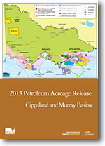
Product description:Executive Summary The 2013 Victorian State petroleum acreage release consists of four blocks; two in the Gippsland Basin in Victorian State waters and two in the Murray Basin over the Netherby Trough This years four Victorian acreage release areas in both the Murray and Gippsland basins are largely under-explored. Blocks 13-1(v) and 13-2(v) are located over the nearshore Central Deep and Southern Terrace of the Gippsland Basin. Previous drilling on the margins of the two blocks and onshore drilling have encountered both liquids and gas in either the top of the siliciclastic Latrobe Group or the underlying Strzelecki Group. Blocks VIC/M-13(1) and VIC/M-13(2) cover a large portion of the underlying Netherby Trough. Geological control in the Netherby Trough is provided by a few wells that intersect the pre-Cenozoic sequence. While there is no seismic data available over VIC/M-13(2), data has been acquired over the three remaining blocks; although coverage and quality is variable. This publication is a summary of information for potential applicants. Download The downloadable version of this report is supplied in PDF format. Bibliographic Reference GOLDIE DIVKO, L.M. & GUZEL, M., 2013. 2013 Petroleum Acreage Release: Gippsland and Murray Basins. Department of Primary Industries. | ||||||
