Back
to Top

 
  • Share this page on Facebook
  • Print this page

Victoria - GIS Data 2010 - MAPINFO Edition
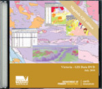
Victoria - GIS Data 2010 - MAPINFO Edition
Category: Geoscientific Data Packages Product Code: MP-D-171397
Free

Product Type*
Download
     Download Info.
 
Sector
Which sector do you represent?


Product description:


Last updated: July 2010

Geoscientific GIS themes include:

  • Detailed 1:50 000 scale geology and regional 1:1 000 000 to 1:250 000 coverage,
  • Geological interpretation of 1:1 000 000 and 1:500 000 geophysics,
  • Mineral occurrence and production data, and
  • Exploration geochemical data.

  • The geoscientific themes are supplemented by important baseline map data such as:

  • Land status (Mining Inspectorates, land exempted from exploration or mining),
  • Exploration and Mining title boundaries (both past and present), and
  • Map sheet data.


  • GIS data themes are provided in MapInfo format.

    Please note: This release contains only GIS data. Other associated databases are available in a separate product “Victoria – Geoscientific Databases 2010”.


    Download:
    This data package is free to download as a compressed ZIP file.

    Victoria GIS Data 2010 MAPINFO (ZIP 511MB)

    Please be patient when downloading large files as this may take some time depending on your internet connection.


    Related products:

    Victoria - Geoscientific Databases 2010 Victoria - Geoscientific Databases 2010 Free  
    Product Type*
    Download
    Victoria - GIS Data 2010 - ESRI Edition Victoria - GIS Data 2010 - ESRI Edition Free  
    Product Type*
    Download