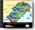
Gippsland Nearshore Airborne Gravity Survey, August 2012
 |
| |||||
Product description:Executive Summary The former Department of Primary Industries commissioned an airborne gravity survey as part of feasibility studies for Carbon Capture and Storage in the Gippsland Basin of Victoria. This project received funding from the Australian Government as part of the Clean Energy Initiative. The survey was conducted by Sander Geophysics Limited (SGL) during November and December 2011 using SGL’s AIRGrav system in a fixed wing aircraft (Cessna Grand Caravan 208B). 10 523 line km of data were acquired along flight lines oriented northeast and southwest at 1000 m line spacing and a nine km wide strip along the coast was flown at 500 m line spacing. Tie lines were flown to the northwest and southeast at 10 000 m line spacing. The survey was flown at an average ground speed of 53 ms-1 with a loose drape of 160-170 m nominal ground clearance and minimum clearance of 305 m above towns. The survey data was acquired and processed on the WGS84 Geodetic Datum and processed gravity data was reduced to the AAGD07 using the AFGN Station 1964919005 at Bairnsdale Airport. The located and gridded data are presented as free air corrected, full Bouguer terrain corrected to 2.50 g/cc and 2.67 g/cc, and Isostatic and Bouguer corrected to 2.50 g/cc and 2.67 g/cc. Line filtering using a low pass 35 sec half wavelength filter was used to reduce statistical noise. Grid filtering was also applied using a three kilometre half wavelength filter. Final three kilometre half-wavelength grids have an estimated RMS error of 1.6 μms-2 (0.16 mGal). A 15 kilometre long section of line 101 was chosen as a repeat test line. This section of line was flown nine times with a combined overall standard deviation of 3.6 μms-2 (0.36 mGal) for the free air data. Geophysical Data Package Contents
Please note ISBN 978-1-74326-216-0 the downloadable version of this data package is supplied as a collection of 5 compressed zip files. Some of the zip files are large and may take time to download Bibliographic Reference DEPARTMENT OF PRIMARY INDUSTRIES, VICTORIA. 2012. Gippsland Nearshore Airborne Gravity Survey - Data Package. | ||||||

