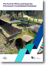
FMQF Technical Record 1 - The Former Mines and Quarries Framework Consolidated Database
 |
| |||||
Product description:Executive Summary:A consolidated database of abandoned and legacy mine and quarry features on Crown land in Victoria has been developed as part of the Former Mines and Quarries Framework (FMQF). The FMQF is a program of work to deliver a state-wide management framework for abandoned and legacy mines and quarries on Crown land in Victoria. This database is the first of its kind developed by the Victorian Government and provides a foundation for the management of abandoned and legacy mine and quarry features in the state. The FMQF database was developed by integrating 14 feeder datasets, including historical records and newly created data, alongside 10 overlay datasets that provide additional context. Verification of feature location and type (e.g. shaft, adit) was carried out both in the field and through desktop methods. Given the age and quality of historical data, the number of features recorded in older datasets likely underestimated the true scale across Victoria. To address this, novel remote sensing techniques, such as Light Detection and Ranging (LiDAR), were employed, uncovering an additional 74,430 features, significantly expanding the dataset to a total of 111,083 recorded features to date. The development of the FMQF database has significantly increased the State’s understanding of where abandoned and legacy mines and quarries are located. However, it is important to note that some parts of this database rely on historical records, so their exact locations cannot always be confirmed. Additionally, these abandoned and legacy mine and quarry features can pose safety risks to the public, so caution is advised if they are encountered. The Victorian Government is actively working to manage the risks posed by these features. This report is the first in a series to more accurately determine the location, scale and magnitude of abandoned and legacy mines and quarries on Crown land in Victoria. Future reports in this series will detail advancements that strengthen Victoria’s capability to identify and manage abandoned and legacy mines and quarries. Bibliographic Reference: Riley, C.P., Eid, R., Lane, R.B., Coxhead, B.M., Castles, K.M., Herley, S.S. & Goldie Divko, L.M., 2025. The Former Mines and Quarries Framework Consolidated Database. Former Mines and Quarries Framework Technical Report 1. Geological Survey of Victoria, Department of Energy, Environment and Climate Action, p. 34. Download: The downloadable version of this report is supplied as (PDF 5 MB), accessible version (MS-word/ODT 6MB) and Attachment A1 data (ZIP 66 MB). | ||||||

