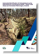
FMQF Technical Record 2 - Automated identification of mining features using Light Detection and Ranging (LiDAR) Golden Plains region, Victoria.
 |
| |||||||||||||||
Product description:Executive Summary:A Light Detection and Ranging (LiDAR) dataset of mine shafts and surface workings (hereafter referred to as mining features) has been developed as part of the Former Mines and Quarries Framework (FMQF) program. The FMQF is a program of work to deliver a state-wide management framework for abandoned and legacy mines and quarries on Crown land in Victoria. This report presents a novel large-scale automated method using LiDAR data and machine learning to automate the detection and classification of historical mining features across the state on Crown land. The Golden Plains region (between Ballarat and Geelong), over the lands of the Wadawurrung, Gulidian, and Dja Dja Wurrung peoples, was selected to test and validate the methodology. The area has an extensive gold mining history and high-resolution LiDAR coverage making it ideal for testing how well an automated method can find and identify old mining features. WSP Global Inc. were engaged by the FMQF program to develop a bespoke, large-scale automated method to detect historical mining features from LiDAR data. This automated method was developed using LiDAR and Digital Elevation Models (DEMs), derived from LiDAR, with geographic and geological overlays, to address the inherent complexities of feature detection. The method included development of a detector-classifier stack, where two detectors were used to identify potential mining features. Attributes were generated from these detections, including a depth estimate, and the method was evaluated for its accuracy and precision with respect to the positive identification of verified mining features. The resultant LiDAR detections were incorporated into the FMQF consolidated database as a feeder dataset (Riley et al., 2025). Through the automated process, 74,430 additional mining features were identified, significantly increasing the existing 1,943 features previously recorded in the historical FMQF database over the Golden Plains region. This report is the second in a series to more accurately determine the location, scale and magnitude of mining and quarrying features on Crown land in Victoria. It highlights the value of innovative techniques in improving the accuracy of historical data and uncovering previously unrecorded features. Future reports in this series will further detail advancements that strengthen Victorias capability to identify and manage former mines and quarries, including the expansion of the automated method presented here across the rest of the State. Bibliographic Reference: Silver, E.R., Dang, L.H., Eid, R., Herley, S.S., Riley, C.P., Travers, S.J. & Tran, L.V., 2025. Automated identification of mining features using Light Detection and Ranging (LiDAR) data - Stage 1 case study over the Golden Plains region, Victoria. Former Mines and Quarries Framework Technical Report 2. Geological Survey of Victoria, Department of Energy, Environment and Climate Action, 24 pp. Download: The downloadable version of this report is supplied as (PDF 4 MB) and Attachment A1 data (ZIP 12 MB). Related products:
| ||||||||||||||||