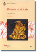
GSV Report 92 - Minerals of Victoria
 |
| |||||||||||||||
Product description:Download The downloadable version of this report is supplied in PDF format (23.8MB). Abstract The Minerals of Victoria map which accompanies this report shows the location and relative size of known mineral occurrences and deposits, which are grouped according to commodity. The information was obtained from a wide variety of departmental records and company exploration reports. A database has been established and an abbreviated listing is given in this report and on the accompanying map. This map and report is a comprehensive revision of the Mineral Deposits of Victoria map by Bell and Liddy (3203), which was last revised as the Mineral Map: Victoria in 1981. For the first time a bibliography and the Australian Map Grid (AMG) co-ordinates of each deposit are given. On the map a colour-coded symbol shows the primary commodity and indicates the approximate centre, or the most important feature, of each deposit. This feature may be a drill hole containing the most significant intersection, a main shaft or adit, or an area of extensive workings. The symbol is plotted from the AMG co-ordinates as they appear in the database. In cases where the deposit covers a large area, the map shows the approximate outline of the deposit, with the AMG co-ordinates in the database reflecting some significant feature of that deposit or the approximate centre. The size of the symbol also indicates the size of the deposit; a small symbol indicates an occurrence of ore mineral(s) but no known production or resource; a medium-sized symbol indicates a minor deposit, usually with little production and/or resource; a large symbol represents a major deposit, with significant production and/or reserves/resource. The deposits are numerically ordered by 1: 100 000 mapsheet number, then by easting. The accompanying number on the map face links the symbol or area to the table on the map. The table contains the name (as commonly recorded in the literature), any other associated commodities and the 1:100 000 map sheet number. A full reference listing can be found at the end of this report. Gold, tin and heavy mineral sands are treated differently from other minerals, because of their tendency to form extensive alluvial deposits, where they may be distributed many kilometres from the original source. The areas shown on the map face represent the extent of their alluvial occurrence which may also include primary deposits, and, in the case of gold, deep and shallow leads. Discrete deposits which have no associated alluvial workings are indicated using the scheme for other mineral deposits as described above. The “fuel minerals”, black coal, brown coal, oil and natural gas, are represented differently on the mineral map than the metallic and industrial minerals. These commodities are restricted to sedimentary basins which may contain large resources, although certain factors such as depth of burial, quality, and size of resource may affect each deposit’s economic viability. They are represented as areas, similar to gold, tin and heavy mineral sands, except that the fuel mineral deposits are mostly subsurface. Bold colouration depicts the subsurface occurrence of fuel minerals, either as a major resource or the current economically recoverable portion. Pale shading indicates the full extent of the resource, which is usually sub-economic. Oil and gas shows are represented by the appropriate well symbol indicating the nature of the occurrence. Discrete coal deposits are shown in the same manner as the metallic and industrial minerals. Some deposits have been grouped together into provinces. The basis for this classification is that particular deposits have similar mineralogical characteristics and strata-tectonic association. This province subdivision largely relates to gold mineralisation, reflecting the importance of gold in Victoria. Other provinces and mineral associations are also recognized, using different criteria, the principal ones being heavy mineral sands and fuels. Characteristics of each mineral province are summarized below. The gold provinces are discussed first, followed by the other provinces and associations. This report also contains brief descriptions of each commodity. A summary table, taken from the database, follows each commodity description (see tables 1 to 38), and lists the deposit name, resource class (major, minor or occurrence), the 1: 100 000 map number and grid reference of each deposit. The location accuracy gives an indication of the precision of the the grid reference as follows: 1 = within 100 metres of stated position. 2 = within 1000 metres of stated position. 3 = location approximate only. The appropriate bibliographic reference number(s) are also given for each deposit. Bibliographic reference Weston, K.S., 1992. Minerals of Victoria. Geological Survey of Victoria Report 92. Related products:
| ||||||||||||||||


