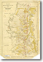
White Horse Range, Ballarat 1:6,336 (1885)
 |
| |||||
Product description:Bibliographic reference THOMPSON, J. & SIMPSON., 1885. White Horse Range, Ballarat. Plan showing the locations of reefs, alluvial workings, leads and mines. Parish of Ballarat 1:6,336 (8 chains:1 inch) geological map. Plan No 518/G/14. | ||||||
