FMQF Technical Record 4 - Development of a spectral reference library for historical mine waste in Victoria
 |
| |||||
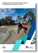
Product description:Executive Summary:The development of a spectral reference library of historical mine waste in Victoria was undertaken as part of the Former Mines and Quarries Framework (FMQF) program. The FMQF is a program of work to deliver a state-wide management framework for abandoned and legacy mines and quarries on Crown land in Victoria. As part of the FMQF program, a pilot project was conducted in the Bendigo region, over the lands of the Dja Dja Wurrung and Taungurung people, to assess the suitability of hyperspectral remote sensing to identify previously unrecorded mine waste sites. As part of the pilot project, a hand-held spectral analysis instrument was used to capture the spectral response and identify key minerals present at 34 historical mine waste sites in central Victoria. A customised spectral reference library containing 200 individual spectra from mine waste categorised into 18 groups was developed using the responses. This new spectral reference library is not represented in existing open-source libraries. Spectral data was also collected from hyperspectral satellite imagery that overlapped select field sites to develop a comparative spectral dataset for use in a target detection workflow. Target detection was employed to test whether the field-acquired and satellite-derived spectra reliably returned the same field sites on hyperspectral satellite imagery when used as target detection inputs. This method assessed the ability of this process to produce a shortlist of possible mine waste sites for further field investigation. Spectra acquired in field, and satellite spectra from sites with consolidated waste over large areas, successfully identified their corresponding sites and highlighted additional sites that may warrant future field investigation for mine waste confirmation. Field spectra from discrete mine waste sites failed to return detection at their sites, while the satellite spectra from these sites were affected by spectral mixing resulting in widespread ambiguous detections across the study area. While this technique does not identify the presence of mine waste, this study has demonstrated how the spectral library may be used to identify areas with similar spectral properties and mineralogy, highlighting sites for further investigation. This technique may be refined through experimentation with the target detection workflow parameters, the size and nature of the waste site, the specific input spectra, and higher resolution hyperspectral satellite imagery. This report is the fourth in a series to determine the location, scale and magnitude of abandoned and legacy mines and quarries on Crown land in Victoria. The work presented here highlights the potential of innovative techniques to uncover previously unrecorded mining features in Victoria. Bibliographic Reference: Riley, C.P., Herley, S.S., Keeble, H.R. & Eid, R., 2026. Development of a spectral reference library for historical mine waste in Victoria. Former Mines and Quarries Framework Technical Report 4. Geological Survey of Victoria, Department of Energy, Environment and Climate Action, 50 pp. Download: The downloadable version of this report is supplied as (PDF 5 MB), accessible version (DOCX 5 MB) and Attachment A1 data (ZIP 7 MB). Related products: | ||||||